Images of climate innovation
The phreatic line
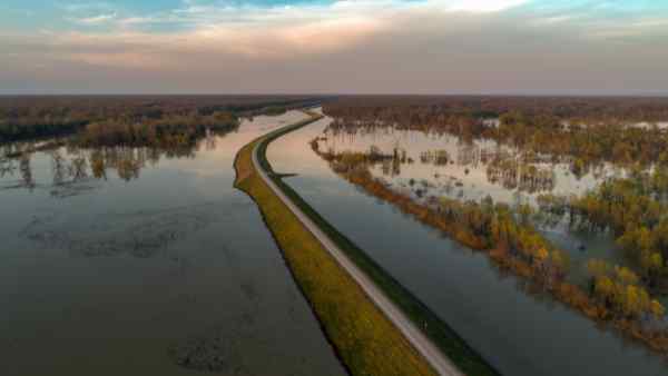
Storm surges and rising sea levels are posing increasingly greater risks to our communities. Many old flood embankments, designed to contain rising water levels, are no longer fit for purpose. Strathclyde research is looking to nature for the answers; through study of the phreatic line – above which soil pores are only partially filled with water – we aim to develop infrastructure that can withstand increasing loads with a minimal footprint, to protect our communities and the environment.

The increase of extreme weather events is a well-established trend observed as a consequence of climate change. In the North Sea, this is anticipated to increase the intensity and duration of storm surges and there is a need to protect communities from the increased flood hazard.
Earthen structures such as flood embankments are the main asset to manage and mitigate flood risk. Increased extreme sea levels require upgrading flood embankments by raising their crest. Flood embankments are generally designed by assuming steady-state flow conditions and that the soil above the phreatic surface is dry. However, steady-state conditions are rarely achieved and a significant portion of the embankment remains unsaturated (i.e. not all the soil pores are filled with water) upon a flood event.
If transient water flow and partial saturation are considered, the flood embankment can be designed with steeper slopes on the landside, which may lead to significant savings in terms of earthfill material (i.e. embodied carbon) and footprint (i.e. habitat compensation and expropriation costs).
The flood embankments of the tidal Elbe River area in Germany require to be retrofitted by raising their crest from 5m to 7m. In this work, the conventional prescriptive design consisting of raising the embankment by maintaining the 1:3 inclination of the landside slope is compared with the performance-based design where the inclination of the slope on the landside is increased up to 1:1, which is proven to be sustainable if partial saturation and transient water flow are taken into account.
It is shown that raising the flood embankment with 1:1 landside slope (rather than 1:3) can lead to expropriation cost savings of the order of 3.9M/km. For the case of a newly built embankment of 7 m height, the saving would become 4.5M/km. An estimation of embodied carbon suggests that the carbon saving could be of the order of 3,100-4,200tCO2e/km.
Entrant: Raniero Beber , University of Strathclyde
Copyright: Justin Wilkins (Unsplash)
Funding: European Commission via the Marie Skłodowska-Curie Innovative Training Networks (ITN-ETN) project TERRE 'Training Engineers and Researchers to Rethink geotechnical Engineering for a low carbon future’ (H2020-MSCA-ITN-2015-675762).
Collaborators: Prof Alessandro Tarantino (University of Strathclyde); Patrick Becker (Kempfert Geotechnik GmbH); TERRE network, H2020-MSCA-ITN-2015.
Links
https://cordis.europa.eu/project/id/675762
https://doi.org/10.1051/e3sconf/202019501002
https://orcid.org/0000-0003-1818-922X